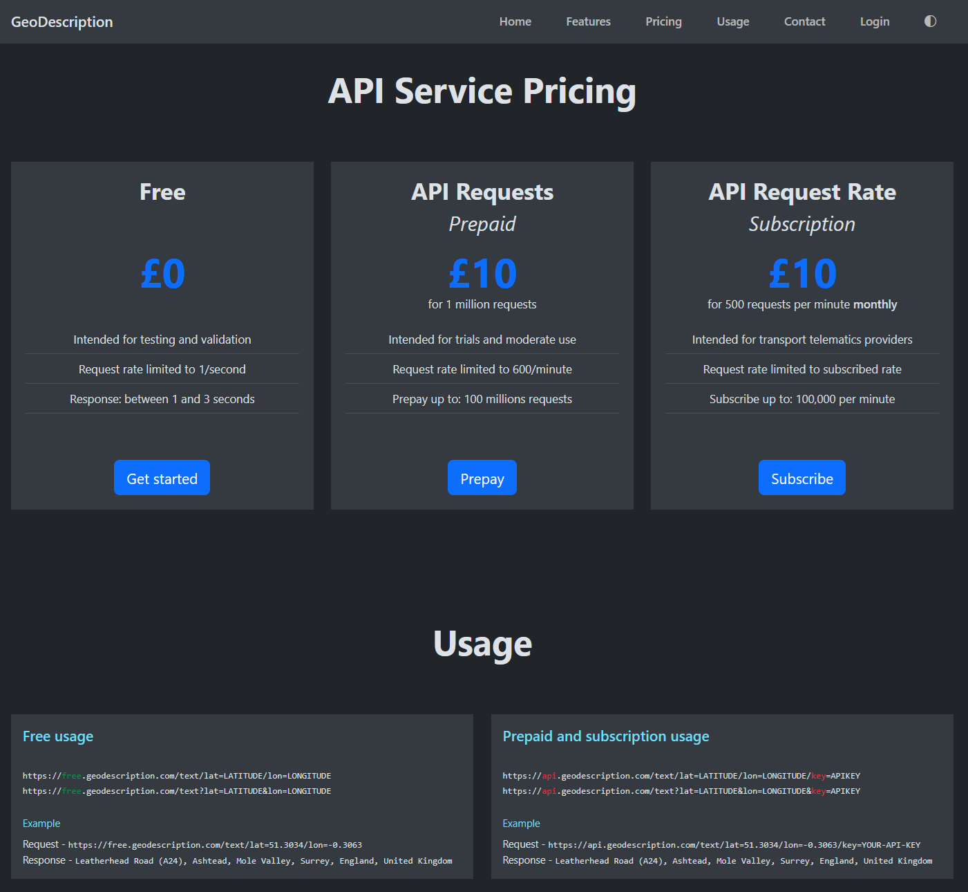
GeoDescription API. A service for reverse geocoding. Converting geographic coordinates to address-like location description. Features include: Bespoke API service designed for high volume commercial usage with clean API service usage design. Streamlined Customer Website to manage API keys, services, usages, payments, purchases, modifications, cancellations and refunds. Customer represented by anonymous login id. And customer's personal and payment data managed by Stripe Payments. Intended for land transport telematics providers for converting geographic position of the vehicles to location description text. Pricing plans include pre-paying for requests and subscribing to a request rate. Starting from $10 prepayment for 1 million requests. Staring from $10 subscriptions for 500 requests per minute.
GeoDescription API

Converting geographic coordinates to address-like location description